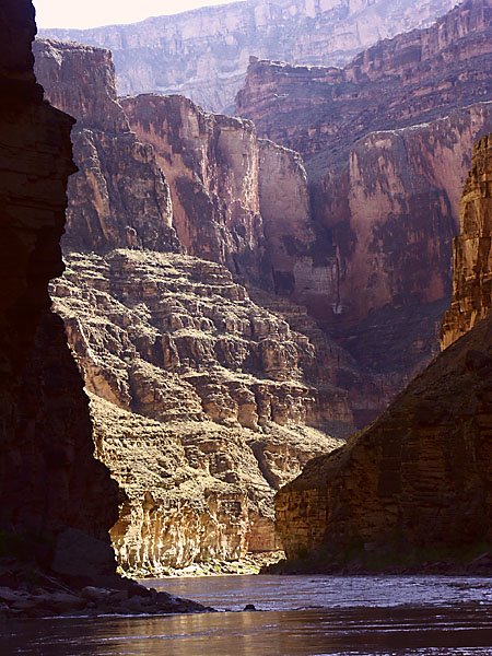
High Mountain Doings

From 8200 feet along one side of the Upper Arkansas River Valley in central Colorado, my blog is about many things: travel including river and bicycle trips, and other experiences as well. The focus is on photography, not lots of text.

Tuesday, October 31, 2006

Bridge at Phantom

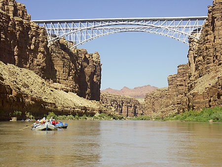
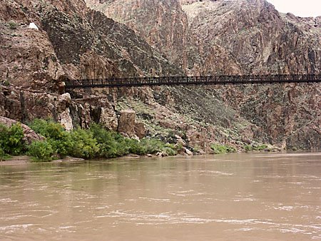
The upstream-most of two such bridges near Phantom Ranch. This bridge was there in the mid-sixties when I was in college. It carried both the Kaibab and the Bright Angel Trails across the river. Later, a second bridge was added, very near the first. The new bridge carries a water pipe through which water goes from the North Rim to the South Rim.

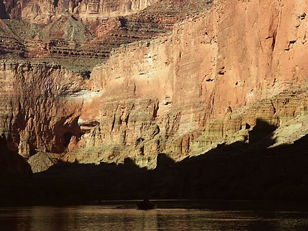
Phantom Ranch is 1/4 mile up the canyon of Bright Angel Creek, north of the river. It's plainly visible from certain South Rim overlooks. There, river runners and hikers can buy prepared food and can mail things--which go out by mule. Those who ride mules into the canyon also stay here.

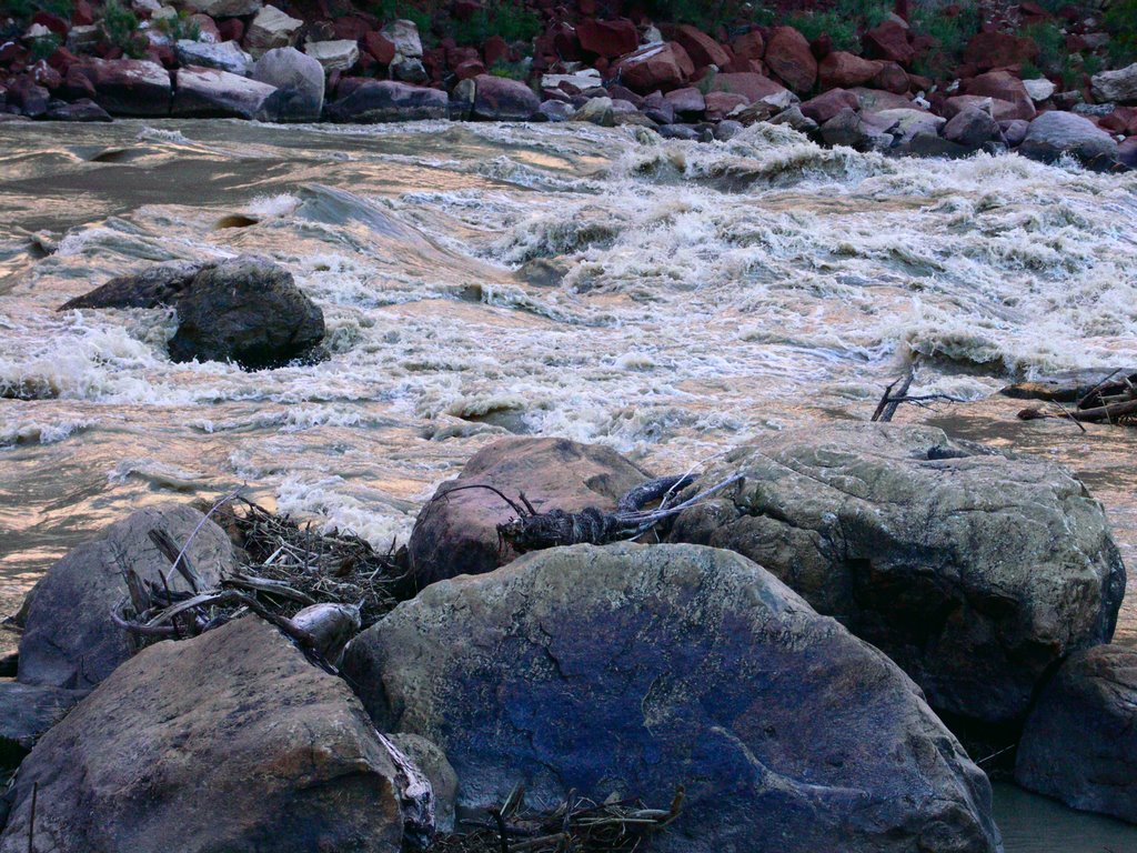
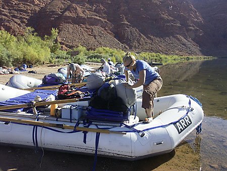
The weather broke nicely as we neared Phantom. The walk up to the ranch was very pleasant, but I failed to take my camera along.

Monday, October 30, 2006

River, Walls, and Rim

Somewhere in the Canyon

Inner Gorge, Oct 14, 2006

Our day into the Inner Gorge was cool and rainy. There were many small waterfalls like this one, though I didn't photograph much because I wanted to keep my camera dry.

Hance Rapid was run in the middle, though a private group was running on the far left, like we did twice at higher water.

The black rocks of the Inner Gorge are polished and wonderful! This is what Precambrian rock oughta look like, in my opinion.

There was a break in the weather as we got to Phantom Ranch, and most of us walked the quarter mile to buy snacks or mail letters. My wallet was packed away, so I only mailed letters.

Horn Creek Rapid wasn't the horror the guides had been talking about, because the water was a bit higher. It was a run between the "horns" where a right entry had been anticipated. This company used to have two dories, until one didn't make the necessary pull in Horn Creek. Now they've only got one dory.

We camped at Granite Rapid this night.

Unkar, October 13, 2006


Our tripmembers gathered on the ledge overlooking Unkar Rapid.

Unkar Rapid, Oct 13, 2006

From our camp at Cardenas (camp named in the Martin/Whitis river guide) near mile 71, there was a fine walk up onto the bluff overlooking Unkar Rapid. A private river trip was going through at the time.

This was Friday the 13th. The sky was becoming overcast and I walked back to camp quickly. The first raindrop fell the moment I reached my tent, and not before! I have zero faith in bad luck predictions on this day/date combination.

Tanner Area, Oct 13, 2006

This is the area near Tanner Rapid, photographed while following a trail that Ivo had cairned some time before, as he did his mapping work in this area. The view is upstream into Marble Canyon at approximately mile 68.

Sunday, October 29, 2006

Carbon--Lava Canyons Hike

This is on the downhill side, headed for Lava Canyon.

Near the saddle between Carbon and Lava Canyons. The latter flows through that big slot

Some of the rock here is "spalling" off, if this is the right turn for the process. The rock exists at a high internal pressure which, when relieved, can result in breaking in this manner.

Claudia makes video of some cracked mud.

Saturday, October 28, 2006

Bent Rocks, Carbon Canyon

Rocks can't bend? Who says they can't bend? These rocks in Carbon Canyon would beg to differ on that point.

These too. This was taken from the summit of the aforementioned high point that we crossed just before reaching the crossover to Lava Canyon. A fault goes through this part of the Grand Canyon, going roughly in the same direction as the river runs. There's been a lot of movement here.

Carbon and Lava Canyons, Approximately mile 65

We walked up Carbon Canyon at mile 64.6, crossed sort of a saddle, and descended down Lava Canyon at mile 65.4 while the crew rowed the boats down to the camp at Lava Canyon. They got the camp, and that's where we stayed that night.

The walk up Carbon is rough and steep. Lots of scrambling around and over rocks, and there's a steep pitch very near the end. Crossing over to Lava Canyon, at one place there's a bypass around an obstacle of some sort--I think a dry falls in the bed of the wash there. Aside from that, it's just a stroll down the sandy wash all the way to the river at Lava Canyon Rapid.


This is at the top of the steep part of the climb up Carbon Canyon. We gathered at the top, on a narrow ridge that extends out to a small promentory. There, Ivo held forth about the local geology. Of particular interest in that area (see Ivo's chart) was the Grand Canyon Supergroup of late Precambrian age. This place is also near a fault that has produced folding, breaking, and overthrusting.


A short walk from here brings you to the place where the trail crosses over to the Lava Canyon drainage.

Anasazi Granery Above Nankoweap

This Anasazi granery is a stiff hike/climb above the camps at Nankoweap. Well, it's a decent trail by Grand Canyon standards! It's well worth the walk up here, though the light wasn't right for the traditional photograph downriver.

One of our tripmembers, who had been here before, waited until everyone else was down and then walked up there herself. Surprise! Not everyone was down. An artist from a different trip was sitting there drawing. But Janette still had a good hike.

Nankoweap, Mile 52, October 11, 2006

At Nankoweap, a high wall rises on the east side of Marble Canyon. It goes all the way to the rim. You can drive to this rim if you know which dirt roads to follow and it's a very severe slope from there to the bottom. A spectacular sight it is, representing the entire depth of the canyon here.

This is the river near our camp. Using the LAB color space, I corrected out the evening blue cast. Some will way that certain images including this one are too red, but the Grand Canyon is a reddish place! Yes, the red color on the rocks here may look strange, but it's based on information in the image from the camera. LAB color tends to accentuate such differences. If in time I don't like this tendency, I can redo the photo in the regular RGB color space. But it would be less dramatic.

Friday, October 27, 2006

Marble Canyon

At least two crew members, including trip leader Brian Hansen (shown here), were making what may very well have been their last commercial trip down the Grand Canyon. River guides move on. Brian is interested in becoming a physician's assistant. Scientific leader Ivo Lucchita was also making his last trip as such. Most of us guessed that he'd be down the river again one way or another, but he's been doing these trips for several years. He and his wife would like to do something else for a change.

Yes, there are nautiloid fossils exposed in the limestone floor of Nautiloid Canyon. This is one of them. It's probably just a little larger than my computer keyboard. Their shells were chambered and they now show up well. This is at mile 35, just a little above Redwall Cavern.

This is a difficult subject to photograph. It required use of the LAB color space in Adobe Photoshop to obtain decent contrast.

But the real highlight of Nautiloid Canyon, in my opinion, is looking up right above the fossils. It's a short, tight canyon with several large rocks that have crashed over the fall. This is obviously not where you want to be during a flash flood. You have to climb up a ledge to get here.


One of our boats above Soap Creek Rapid, mile 12.

Marble Canyon

Redwall Cavern at mile 35. This is where an opening has been eroded into the massive Redwall Limestone. That opening has been lined with a floor of sand although no new sand is being added now because of Glen Canyon Dam upstream.

Soap Creek Rapid, mile 12, late afternoon. This was our first camp.

The walls of Marble Canyon. Actually, much of the rock is limestone, not marble. The massive red cliff pictured is the Redwall Limestone. It's not actually red inside, but is colored on the surface by other material that has washed down over it. Where the Redwall is at river level, there are unforgettable vertical cliffs along the water.

We've just passed under Navajo Bridge, about four miles downstream from our launch at Lee's Ferry. There are two bridges visible. A wider one was built several years ago and the old one (farthest away, upstream) is now a footbridge. With our boat already set up, a friend and I walked out onto it several years ago, the evening before my last Grand trip.

There came a time when the Lee's Ferry boat washed away. I think it was 1929. Navajo Bridge wasn't quite finished yet and the next place downstream where vehicles could cross the river was Hoover Dam, far downstream! A rather short trip to the other side of the new bridge suddenly became very long.

Into Marble Canyon on October 8

Geologist Ivo Lucchita makes a point about Grand Canyon Geology. He would usually point out some things about the canyon each morning, and often there would be further discussion during the day. There'd be a hike to a point of interest, a walk up a canyon, or, in one case, a walk/climb up Carbon Canyon followed by an easier walk down Carbon Canyon to our camp. There's some spectacular geology up there. Ivo brought a goodly supply of maps and other teaching aids.

Ivo is the author of Hiking Arizona's Geology.

Grand Canyon River Trip


This was a commercial river trip run by ARR. The group was organized by Jan Taylor of Southern California around geologist Ivo Lucchita of Flagstaff, Arizona. Ivo led several hikes/climbs and presented much about the geology of the Grand Canyon. Ivo spent much of his career doing geologic mapping and interpretation in the Grand Canyon.

We launched on October 8 and took out at Diamond Creek on October 23, 2006.

Lee's Ferry, Arizona, is the only place you can begin a Grand Canyon river trip. It's just a few straight line miles from Page, Arizona. Here are our boats at the launch ramp there, getting ready to go. Erica (pictured) would be one of our guides.

In a blog, subsequent posts will be ABOVE this one. This is the first Grand Canyon trip post.

Thursday, October 05, 2006

Aspen Ridge to Mt. Princeton


This is the view from Aspen Ridge, across Colorado's Upper Arkansas River Valley, to 14197 foot Mount Princeton--a mountain that's just a few miles southwest of Buena Vista. My house is in the valley at 8200 feet, hiding behind one of the trees in this photograph.
Photo Oct 2, 2006.