Past Confluence, Into Cataract
 This is the former Colorado River several miles beyond the end of rapids in Cataract, destroyed by Glen Canyon Dam. Though Powell Reservoir is now low, the river is backed up by something. Downstream of Mille Crag Bend, the current goes to nearly zero. Rowing out of there is hard work, and we had no wind. It's pretty but not natural.
 Big Drop III Rapid, a.k.a. Satan's Gut, where success depends upon hitting a narrow slot at the top. If you do that, the run seems almost automatic. At somewhat higher water, about 10,000 cfs or so, you run the far right. This was about 6500 cfs.
 Big Drop I Rapid. This is a straightforward rapid, but the water is rough, pitching the raft around. It's mostly a matter of picking where you want to enter that first wave.
 This is Capsize Rapid, or Rapid #15. The earliest rapids in Cataract are easy. This is the first challenging one, and it's not hard as long as you take one of two correct routes, missing that middle rock.
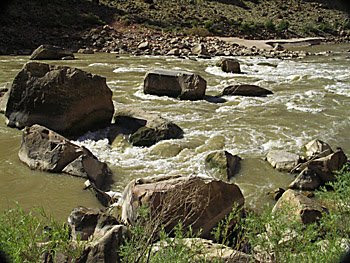
 A fan of rocks below the mouth of a tributary to the Colorado River in Cataract Canyon, taken from the raft where we stopped for a few minutes.
 This sign and signup box are just over two miles below the confluence. Used to be on the right about two miles down, but they were moved. You need to have a Cataract river permit to be here at all, but this box is to sign up for campsites. But I think there were only two other trips in the canyon when we signed in.
Labels: called "Graveyard of the Colorado.", Cataract Canyon


